According to Nature, a new predictive framework called the Multi-Level Spatial–Temporal Gated Graph Convolutional Network (MLSTGGCN) has been engineered to solve persistent challenges in urban mobility planning. While bikesharing systems are vital for low-carbon transportation, accurately predicting where and when bikes will be needed remains difficult in cities with non-uniform layouts. The new model addresses this by moving beyond simple historical data to incorporate the physical realities of the streets between stations.
A dual-graph approach to urban mobility
The MLSTGGCN framework distinguishes itself by using two complementary graphs to represent a city's transit network. The first graph focuses on station-level dynamics, capturing how demand fluctuates over time across different hubs. The second graph models the candidate routes connecting these stations. This allows the AI to understand not just where people start and end their journeys, but the specific environmental hurdles they face during the trip.
The researchers enriched the path-level data with several critical variables that influence rider behavior, including:
- Terrain slope and elevation changes
- Level of Traffic Stress (LTS) for cyclists
- Local land use patterns
- Crime exposure levels
- Availability of dedicated cycling infrastructure
Testing in complex topographies
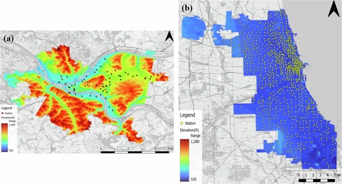
To validate the model, the team utilized data from Pittsburgh’s POGOH bikesharing system. The city was chosen specifically because its geography—characterized by steep hills, river valleys, and fragmented bicycle networks—poses significant challenges for standard forecasting models. Traditional methods often rely on grid-like assumptions that fail in such irregular environments.
The results indicated that the MLSTGGCN outperformed existing benchmarks, including attention-based and gated graph models, across multiple performance metrics. By capturing the interplay between station demand and route context, the system provides a more scalable and interpretable tool for city planners. "The framework supports more efficient operations and informs infrastructure planning," the study notes, highlighting its potential to guide strategic investments in docking facilities and safer cycling paths.
Implications for urban sustainability
By providing high-accuracy forecasts, this technology enables bike-share operators to optimize bike redistribution more effectively. This reduces service downtime and ensures that bikes are available where they are most needed. Ultimately, the integration of multi-level spatial data helps create more resilient, low-carbon transportation networks in diverse urban settings.